MapPlace 2 data
Topographic base maps and geoscience data on MapPlace 2 are organized by folders, and themed as map layers with styles and symbols shown in the Legend Pane. For each of the data products, map themes are listed and accompanied by a screen shot of the map layers in the Legend Pane showing the styles or symbols. A more detailed description for the data product is provided in the information side bar.
Topographic base maps and imagery from third-party providers
MapPlace 2 gives access to base maps and imagery from third-party providers including Google (Google Streets, Google Hybrid, Google Physical), Microsoft (Bing Maps Street, Bing Maps Satellite), and OpenStreetMap (TransportMap, CycleMap). These are available from ‘External Providers’ on the top Toolbar. A list of available features on each of the layers is provided in Table 1 for comparison. The base maps and imagery differ in resolutions, topographic features, and hillshades. For example, OpenStreetMap (CycleMap) provides extensive coverage of trails and resource roads that are unavailable in other base maps. Toggle between the options and select those that suit your needs.
List of features from third party providers:
|
External provider |
Layer name |
Features |
|
|
Google Streets |
road network with topographic features |
|
Google Hybrid |
road network on satellite imagery and aerial photography | |
|
Google Physical |
road network on hillshades and contours |
Microsoft |
Bing Maps Streets |
road network with topographic features |
|
Bing Maps Satellite |
road network on satellite imagery and aerial photography | |
|
OpenStreetMap |
OpenStreetMap |
road network with more detailed topographic features |
|
TransportMap |
road network with topographic features | |
|
CycleMap |
road network, routes for cycling, and trails on top of hillshades and contours |
When one of the Google maps is chosen for display, the Google StreetView (on top Toolbar) can be used to view StreetView, Photo Sphere, and ‘See inside’: drag the magnifying glass with a flashlight to the location, and display the view in the Tasks pane.
Third-party base maps and imagery from ‘External Providers’ are recommended for typical use and for better performance than the detailed topographic maps summarized below. Due to licensing restrictions, the base maps and imagery from ‘External Providers’ cannot be printed using Quick Plot and ‘Print’; attempting to do so will generate a blank page. However, the Base Maps summarized following can be printed. See Section 3.9 for more details on making custom maps.
Base Maps
This folder contains base maps from the MapPlace 2 web server. By turning on the Open Street Map folder, a topographic base map similar to OpenStreetMap is shown. It includes features such as road network, railway, trails, hydrography, and land use (e.g., residential, commercial, agricultural, schools, forested, parks). A legend for these features is unavailable. However they have common topographic themes and styles that are similar to those in OpenStreetMap. The labels and Maptip for most features also provide explanation. Due to the large volume of data, certain maps or details (e.g., contours) are only visible when zoomed to a certain level (e.g., at a scale greater than 1:100,000). The following map layers are also available.
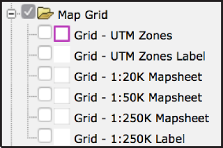
Map Grid
Topographic Features
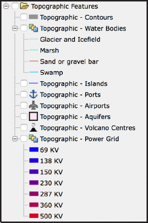
Maps from the ‘Base Maps’ folder are recommended for making custom maps, or for accessing features unavailable from the ‘External Providers’, (e.g., UTM Grid and Power Grid).
Places
This folder contains named communities and places in British Columbia.

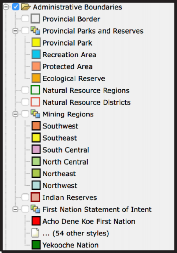
Administrative Boundaries
This folder contains administrative boundaries for natural resources, First Nations, and provincial parks.
Mineral Inventory
The ‘Mineral Inventory’ folder contains maps and reports that are related to minerals, including Assessment Reports (ARIS), Coal Assessment Reports, Prospectors Reports, Property File, and mineral occurrences (MINFILE).
Assessment Reports (ARIS)
The Assessment Reports are themed by year, expenditure, and, if digital data available, by year.
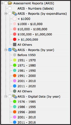
 ARIS (Assessment Report Indexing System) is the searchable database of over 36,000 assessment reports submitted to the Ministry of Energy and Mines. These reports summarize results from exploration programs on mineral claims dating from 1947. After a one-year confidentiality period, the reports become an open resource for planning mineral exploration, investment, research, land use, and resource management. ARIS archives previous exploration results so that explorationists can advance projects without duplicating previous work. Between 1967 and 2015, about $2.6 billion of exploration expenditures has been reported in ARIS. Assessment reports contain information on geology, geochemistry, geophysics, sampling, drilling, prospecting and physical work. Data in digital format from 450 Assessment Reports can be downloaded through the ARIS web application (
http://aris.empr.gov.bc.ca
), where ‘Digital Data’ is a searchable keyword. More information about ARIS is available at:
http://www.empr.gov.bc.ca/Mining/Geoscience/ARIS/Pages/default.aspx
ARIS (Assessment Report Indexing System) is the searchable database of over 36,000 assessment reports submitted to the Ministry of Energy and Mines. These reports summarize results from exploration programs on mineral claims dating from 1947. After a one-year confidentiality period, the reports become an open resource for planning mineral exploration, investment, research, land use, and resource management. ARIS archives previous exploration results so that explorationists can advance projects without duplicating previous work. Between 1967 and 2015, about $2.6 billion of exploration expenditures has been reported in ARIS. Assessment reports contain information on geology, geochemistry, geophysics, sampling, drilling, prospecting and physical work. Data in digital format from 450 Assessment Reports can be downloaded through the ARIS web application (
http://aris.empr.gov.bc.ca
), where ‘Digital Data’ is a searchable keyword. More information about ARIS is available at:
http://www.empr.gov.bc.ca/Mining/Geoscience/ARIS/Pages/default.aspxCoal Reports and Data
The COALFILE - Assessment Reports and COALFILE - Boreholes layers are themed by report year.
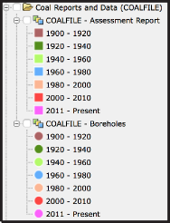 COALFILE is a collection of assessment reports, maps, and data from boreholes, trenching, and sampling dating from 1900. COALFILE contains 990 reports, 5570 maps, 16,090 boreholes, 3640 trenches, and information about 550 bulk samples. There is a web-enabled application to search COALFILE reports (
http://webmap.em.gov.bc.ca/mapplace/coal/search.asp). For more information see
http://www.empr.gov.bc.ca/Mining/Geoscience/Coal/Pages/default.aspx
COALFILE is a collection of assessment reports, maps, and data from boreholes, trenching, and sampling dating from 1900. COALFILE contains 990 reports, 5570 maps, 16,090 boreholes, 3640 trenches, and information about 550 bulk samples. There is a web-enabled application to search COALFILE reports (
http://webmap.em.gov.bc.ca/mapplace/coal/search.asp). For more information see
http://www.empr.gov.bc.ca/Mining/Geoscience/Coal/Pages/default.aspxProspectors Reports
The Prospectors Reports layer is themed by report year
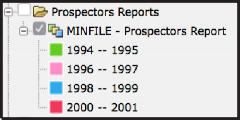
Prospectors Reports contains reports from the Prospectors Assistance Program (now discontinued) which provided grants to encourage grassroots prospecting in British Columbia. The Prospectors Assistance Program contributed up to 75 per cent of the eligible costs of a proposed prospecting program to a maximum of $10,000. The reports were submitted from 1994 to 2001. These documents have been amalgamated into Property File and linked to MINFILE occurrences when possible. For more information, see:
http://www.empr.gov.bc.ca/Mining/Geoscience/PropertyFile/Pages/ProspectorsReports.aspxProperty File
The Property File layer is themed by number of documents
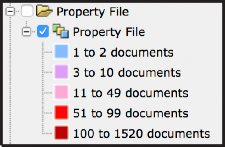
Property File is a collection of about 100,000 documents donated to the British Columbia Geological Survey over the last 150 years by government, university, industry, and individuals. To date, over 60,000 documents have been indexed, scanned, and made available to the public. These documents include unpublished reports, theses, papers, field notes, company prospectuses, correspondence, hand-drawn maps, geology, geochemistry, geophysics, drilling data, claim maps, mine plans, and photographs. The public can search the document index, link through MINFILE, and view the PDFfiles, at
http://propertyfile.gov.bc.ca
. For more information see
http://www.empr.gov.bc.ca/Mining/Geoscience/PropertyFile/Pages/default.aspx

Mineral Occurrences (MINFILE)
Mineral occurrences are themed by status.
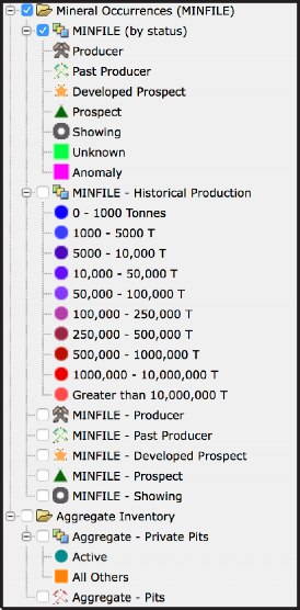
MINFILE is an inventory documenting more than 14,600 metallic mineral, industrial mineral, and coal occurrences in British Columbia. MINFILE has a web-enabled application ( http://minfile.gov.bc.ca ) where mineral occurrences can be searched by location, mineralogy, commodities, host rocks, deposit type, geological setting, age, production, and references. The MINFILE application also has a secure online process to capture and edit data. MINFILE contains links to related Assessment Reports. MINFILE is themed on MapPlace 2 by status:
• Producer (currently producing mine): occurrences from which ore containing one or more commodities is being mined.
• Past Producer (Past producing mine): occurrences that are not currently being mined but have recorded production in the past.
• Developed Prospect: occurrences on which exploration and development have progressed to a stage that allows a reasonable estimate of the amount(s) of potentially mineable commodities.
• Prospect: occurrences documented as containing mineralization that warrants further exploration.
• Showing: occurrences with minor in-situ mineralization
For more information see http://www.empr.gov.bc.ca/Mining/Geoscience/MINFILE/Pages/default.aspx

Mineral Titles
The ‘Mineral Titles’ folder contains Mineral Titles Online (MTO) data available from the British Columbia Geographic Warehouse (BCGW). The MTO data in BCGW are delayed by one day.
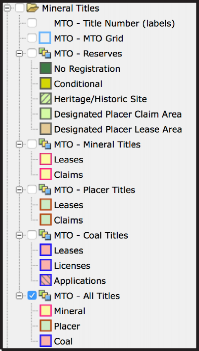
MTO - MTO Grid
MTO - Title Number (labels) MTO - All Titles
Mineral Placer Coal
MTO - Mineral Titles MTO - Placer Titles MTO - Coal Titles MTO - Reserves
No Registration Conditional Heritage/Historic Site
Designated Placer Claim Area Designated Placer Lease Area
Mineral Titles Online (MTO) is a GIS-based system that enables the exploration industry to electronically acquire and maintain mineral, placer, and coal rights. For more information see https://www.mtonline.gov.bc.ca. Maplace 2 draws mineral title data from the British Columbia Geographic Warehouse which is delayed by one day. For more information see https://data.gov.bc.caMapPlace 2 is constantly evolving, new tools and layers are added on a regular basis. Recent additions of note include: Survey Parcels (including Crown Grants and Right of Ways), Landuse Planning layers and Environment Canada Climate Station layers.Geology: Bedrock geology
This folder contains the most current province-wide bedrock geology, and a number of related maps, including terranes, tectonic assemblages, basins, and physiogeographic areas.
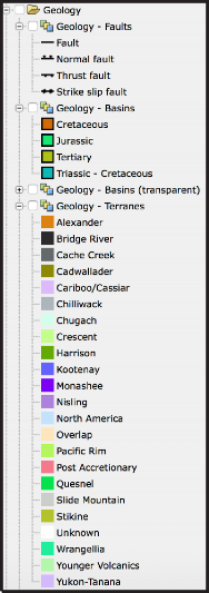

Geology - Tectonic Assemblages
The source and legend of this map: Wheeler, J.O., and McFeely, P. (comp.), 1991, Tectonic Assemblage Map of the Canadian Cordillera and adjacent parts of the United States of America; Geological Survey of Canada, Map 1712A, scale 1:2,000,000.
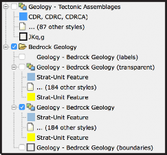
The British Columbia Geological Survey delivers a continuously updated, downloadable provincial bedrock geology map. The current edition operates in a spatial database, using a geospatial frame data model and anchoring mechanism to simplify the map compilation and integration. The data download contains tables for geological units and suggested legend colours in RGB, ESRI ArcGIS layer files, and an image illustrating the suggested colour theme for the bedrock polygons.For more information see http://www.empr.gov.bc.ca/Mining/Geoscience/BedrockMapping/Pages/default.aspxSurficial Geology
This folder contains the British Columbia part of Geological Survey of Canada map 1880A (Surficial materials of Canada; R.J. Fulton, 1995) and an ice-flow indicator map and surficial geology map index compiled by the British Columbia Geological Survey.
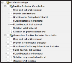
Ice flow indicators are themed by landform or outcrop and flow direction.
Landform-scale (e.g., drumlins and flutes) and outcrop-scale (e.g. striations and grooves) ice-flow indicators record the movement of glaciers over the landscape. A compilation of ice-flow indicators digitally captured from published and unpublished surficial geology, terrain, glacial features, and bedrock geology maps has been produced for British Columbia. These data illustrate ice-flow directions for the glaciers during the Late Pleistocene. For more information about surficial geology in British Columbia, see http://www.empr.gov.bc.ca/Mining/Geoscience/SurficialGeology/Pages/default.aspx

Surficial Geology (GSC)
Surficial Geology - Map Index (by map scales)
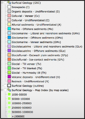
Surficial geology maps show the spatial distribution of surficial materials and their surface expression. As with any geological map, surficial geology maps are created by defining internally consistent map units, establishing the nature of map unit boundaries, and establishing map unit geometries. Units are defined by surficial material type and surface expression.The surficial geology map index for British Columbia includes 218 maps available for download. The index can be searched in fields such as author, source type, source series, and map scale. Publication page URLs are supplied for each map from which the source files, PDFs or digital data can be downloaded.Geochemical Data
This folder contains themes for data from the Regional Geochemical Survey (RGS), till samples, and rock samples.
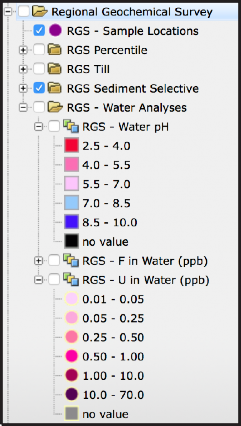
Regional Geochemical Survey (RGS)
RGS - Sample Locations
RGS Sediment Selective
These elements are themed by ICPMS, INAA and / or AAS: Ag, As, Au, Co, Cr, Cu, Fe, Mo, Ni, Pb, Sb, and Zn
RGS - Water Analyses
RGS Percentiles

Note: percentiles for each of the themes: 99th,95th, 90th, 70th, 50th, < below 50th
RGS Till
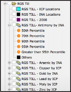
Note: percentiles for each of the themes: 99th, 95th, 90th, 70th, 50th, below 50th
The British Columbia Geological Survey maintains geochemical databases containing multielement analyses from rock, till, stream-sediment, and water samples. For example, the Regional Geochemical Survey (RGS), includes determinations for up to 60 elements from over 64,000 sites covering about 80% of the province. For more information see
http://www.empr.gov.bc.ca/Mining/Geoscience/Geochemistry/Pages/default.aspxRock Property
The rock property data for 11,582 sites are themed by measurements of magnetic susceptibility, electrical conductivity, and density.
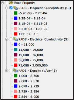
The rock property data are from the Rock Properties Database System (RPDS), a Geoscience BC project partnered with Mira Geoscience, the Geological Survey of Canada and the Canadian Mining Industry Research Organization (CAMIRO). This database brings together geophysical and geological information and assigns physical property values to geological units. Using this information to characterize the rock property environment of specific ore deposits can improve geophysical survey design, forward modelling, inversion, and interpretation. The physical properties, mostly density and magnetic susceptibility, along with location, lithology and other metadata have been compiled for 13,555 sites. For more information see
http://www.empr.gov.bc.ca/mining/geoscience/publicationscatalogue/openfiles/2008/pages/2008-4.aspx

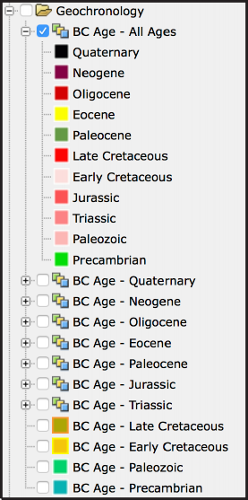
Geochronology
Database contains 7,779 isotopic ages complied by the Pacific Centre for Isotopic and Geochemical Research at the University of British Columbia. The database has details on sample location, sample description, dating methods, laboratories, ages and uncertainty, interpretation, and information on data sources. Geochronologic methods include Ar/Ar, Fission Track, K/Ar, Pb/Pb, Rb/Sr, Re/Os, Sm/Nd, U-Th/He, and U/Pb.Mineral Resource Assessment
This folder contains mineral resource assessment themed for metallic mineral potentials by rank and industrial mineral potential by rank.
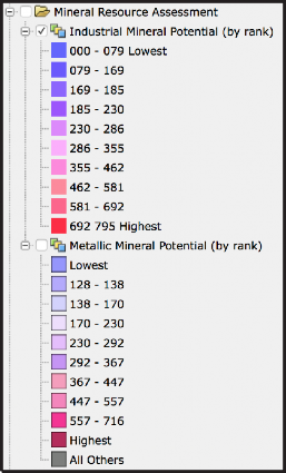
The Mineral Resource Assessment (MRA) of British Columbia began in early 1992 to support geological compilations and land-use planning. For more information see http://www.empr.gov.bc.ca/Mining/Geoscience/MineralPotential/Pages/default.aspxGeophysical Surveys
This folder contains a geophysical survey index, links to data download sites, and displays of geophysical data themed by types of surveys.
Geophysical Surveys
Geophysical Survey Index Geophysical Surveys
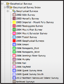
Geophysical Survey Data
Seismic Lines
Llewellyn Aeromagnetic Survey (GM2017-02) BC Gravity
BC Mag
Nechako Basin Gravity
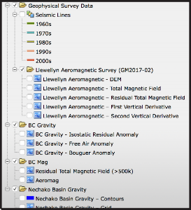
The geophysical survey database includes multisensor, airborne geophysical surveys of targeted areas across the province. Most of the surveys were carried out in cooperation with the Geological Survey of Canada and industry partners. For more information see http://www.empr.gov.bc.ca/Mining/Geoscience/Pages/GeophysicalData.aspxPublication Catalogue
Reports and maps by the British Columbia Geological Survey can be search for and downloaded from the Publication Catalogue under the Tasks Pane on MapPlace 2.
Reports and maps produced by the British Columbia Geological Survey since 1874 can be searched for, and downloaded at no cost from, the Publications Catalogue. The Survey currently publishes Papers, Open Files, GeoFiles, Geoscience Maps, and Information Circulars. The catalogue is searchable by author, title, keyword, abstract, year, NTS map, scale, series, publication number, .and map extent. Results to searches are displayed as footprints and a report with a URL link to the publication in PDF and/or digital formats. For more information see
http://www.empr.gov.bc.ca/Mining/Geoscience/PublicationsCatalogue/Pages/default.aspx