After you have opened your map and moved it around to display the features you want, you can identify the map features, measure distances between them, and follow any links they contain.
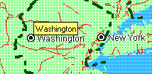
When you pause the mouse pointer over a map feature, you see the name of that map feature displayed in a small yellow popup window called a MapTip. For example, when you position the mouse pointer over Washington, the MapTip displays the name of the city, as shown in the following illustration.

The MapTip disappears when you move the mouse again. If a name has not been provided for this feature on this map, the MapTip does not appear.
Also, if the map has a status bar, you will see the layer name and the name of the map feature displayed on the status bar when you pause the mouse pointer over the map feature, as shown in the following illustration.

In this illustration, the status bar indicates that the mouse is currently positioned over Washington, which is on the Major Cities layer.
You can measure the distance between two points on the map. You can also measure the distance between several points to get a cumulative total distance. For example, if you want to know approximately how far you would travel if you flew from Paris to London to New York, you could measure each leg of the trip and get a cumulative total. Note that, depending on which map projection the author of the map chose, the distances measured may vary in accuracy. For example, if the map author chose a projection that provides the most accurate results when you measure the distance between two points in France, the accuracy will decrease if you measure the distance between points across the world. For more information, contact the author of the map.
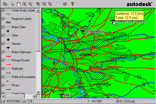
As you move the pointer, the measurement of the distance appears dynamically in a MapTip (the yellow box), as shown in the illustration below. If the Display Mouse Position check box is selected in the Preferences dialog box, the coordinates of the cursor are displayed in the status bar.

You may notice when you measure distances in some maps that the MapTip displays "Great Circle Distance" rather than "Distance." This means that the map author specified that the Great Circle distance formula be used for measuring distances instead of the default Euclidean formula. Great Circle distance measurement is more accurate than Euclidean measurement for maps that use geographic coordinate systems. In rare circumstances, you may notice that the MapTip for distance measurements changes from "Great Circle Distance" to "Distance" within the same map. If this happens, it means that you have a selected a point that cannot be measured using the Great Circle method because it is outside the mathematical range of the map projection.
The distance between the second and third point appears on the status bar and in the MapTip display, along with the total of all distances measured.
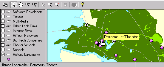
When you pause the mouse pointer over a feature that is linked to a Web page, the pointer changes from an arrow to a pointing hand ![]() , as shown in the following illustration.
, as shown in the following illustration.

The name of the feature appears in a MapTip, and the uniform resource locator (URL) of the Web page linked to this feature appears at the bottom of your Web browser window. To display the linked Web page, double-click the feature.