

| Publication Summary
|
| Issue ID: | OF2003-07 |
| Title: | Quaternary geology of the Hydraulic map sheet, British Columbia (NTS 93A/12) |
| Author(s): | Bichler, A.J., Bobrowsky, P.T. |
| Purpose: | To produce a quaternary geology map of the Quesnel/Likely area. |
| Series Name: | Open File |
| Publication Year: | 2003 |
| Scale: | 1:50000 |
| NTS Map Sheet(s): | 093A/12 |
| Place Keyword(s): | British Columbia, Quesnel Highlands, Fraser Plateau, Quesnel River, Caribou River |
| Lat/Long (NSWE): | 52.75, 52.5, -122, -121.5 |
| Theme Keyword(s): | Surficial Geology Map, Quaternary Geology, Surficial Geology, Pre-late/late Wisconsin, Holocene |
| Download(s): | PDF, ZIP (View Zip Contents) |
Abstract: 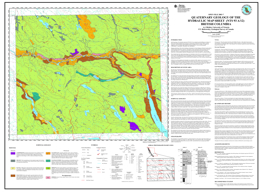 | Surficial geology of the Hydraulic map sheet (NTS 93A/12) was mapped in partial fulfillment of the Master's of Science thesis being conducted at the University of Victoria and in association with the British Columbia Geological Survey and the Geological Survey of Canada. The study area was divided into terrain units based on the surficial material, geomorphic attributes, and geologic/geomorphic processes found within their boundaries. Each enclosed terrain unit, or terrain polygon, represents a homogeneous parcel of land with respect to its inherent attributes. Three hundred and twenty eight terrain polygons were identified of which 104 were ground-truthed by 137 field stations. For all field stations, location and a description of the surficial material including its type, texture, thickness and geomorphic expression were recorded. |


