

| Publication Summary
|
| Issue ID: | OF2010-08 |
| Title: | Surficial geology of the Komie Creek area (NTS 94P/5) |
| Author(s): | Demchuk, T.E. |
| Series Name: | Open File |
| Publication Year: | 2010 |
| Other Citation Details: | Also published as Geological Survey of Canada Open File 6568 |
| Larger Work Citation: | Also published as Geological Survey of Canada Open File 6568 |
| Scale: | 1:50000 |
| NTS Map Sheet(s): | 094P/05 |
| Place Keyword(s): | British Columbia, Northeast, Komie Creek |
| Lat/Long (NSWE): | 59.5, 59.25, -122, -121.5 |
| Theme Keyword(s): | Surficial Geology Map, Surficial Geology, Glacial Features |
| Download(s): | |
Abstract: 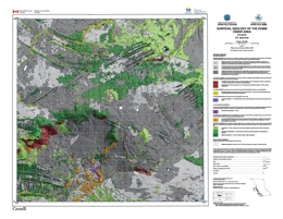 | Komie Creek map area was fully glaciated by the Laurentide Ice Sheet (LIS) during the Late Wisconsinan Fraser Glaciation. Ice flow during the glacial maximum was towards the southwest, as indicated by the orientation of streamlined landforms on the Etsho Plateau. At some time after the Fraser Glaciation maximum, the LIS divided into two lobes (upland and lowland). The subsequent landform assemblages, highlighted well in LiDAR imagery, provide evidence that the upland lobe retreated to the northeast and the lateral margin of the lowland lobe dropped to the southwest. Organic deposits are the dominant surficial material type in the Komie Creek map area. They have accumulated and been deposited on poorly drained clay and silt-rich morainal and glacio-lacustrine deposits. Morainal deposits are the next most common surficial material type in the area and dominate along the top of the Etsho Escarpment and in the northeast corner of the study area. Glaciofluvial deposits are rare. During ice retreat, an ice-marginal lake formed in the south-central part of the study area where the lowland lobe prevented drainage of meltwater out of the area. An aerially extensive landform, interpreted as an ice-contact glaciofluvial delta complex, was deposited into this dynamic glacial lake. The lake levels rose abruptly several times during delta deposition as a result of large west-flowing outburst floods in the Cabin Creek melt water channel, generated when a glacial lake breached its margins on or under the upland lobe. The delta is composed of several lobate landforms that sedimentologically are highly variable. A new, detailed 1:50,000-scale surficial geology map for the Komie Creek map area is presented in this Open File. This map was generated using aerial photographs, LiDAR DEMs, ground-based geophysics and field observations. |


