

| Publication Summary
|
| Issue ID: | GM2018-01 |
| Title: | Surficial geology of the Highland Valley Copper mine area (Parts of NTS 092I/06, 7, 10 and 11), British Columbia |
| Author(s): | Plouffe, A., and Ferbey, T. |
| Series Name: | Geoscience Map |
| Publication Year: | 2018 |
| Scale: | 1:50000 |
| NTS Map Sheet(s): | 092I/06, 7, 10 and 11 |
| Place Keyword(s): | British Columbia, Central British Columbia |
| Lat/Long (NSWE): | 50.6, 50.25, -121.2, -120.75 |
| Theme Keyword(s): | surficial geology, Highland Valley Copper mine, Guichon Creek batholith, till geochemistry, porphyry copper indicator minerals |
| Download(s): | PDF, ZIP (View Zip Contents) |
Abstract: 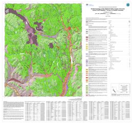 | Late Wisconsinan, Fraser glaciation till is the most extensive surficial sediment in the Highland Valley Copper mine (porphyry Cu-Mo) area. During the Fraser glaciation, ice flowed predominantly south to southeastward as indicated by the orientation of drumlins and flutings. During deglaciation, lateral meltwater channels cut into the flanks of valleys and mountain slopes, indicating that ice occupied low ground when higher elevations were ice free. Accumulations of glaciofluvial sand and gravel, too small to be mapped at this scale, can be found close to these meltwater channels. The glaciofluvial drainage was generally to the south during ice retreat, with aggradation of glaciofluvial sediments in the Guichon Creek valley. Glaciolacustrine sediments in the Witches Brook valley were deposited in a lake that formed when the eastward drainage was blocked by a mixture of ice and sediments. Mine tailings blanket areas near open pits and in the valley that extends northwest from the mine (previously occupied by Pukaist Creek). |


