Build Assessment Report Maps
*Warning* ARIS MapBuilder may lose functionality in the event MapPlace1 is retired. Similar maps can be generated using the Print and Quick Plot tools in MapPlace2.
The ARIS MapBuilder can be used to quickly produce maps to partially fulfill assessment reporting requirements. Property location maps, claim maps, and tenure reports can be generated. The ARIS MapBuilder also creates a .kml file to show claims in viewers such as Google Earth.
Important Information – Read before using ARIS MapBuilder:- To use the ARIS MapBuilder, you must download the Download Autodesk MapGuide ActiveX Control for Internet Explorer (ZIP, 2.9 MB)
- The ARIS MapBuilder works best with Internet Explorer (IE), but does not function in IE10. ARIS MapBuilder will not draw a location map or claim map based on tenure input. These functions work in IE9 and earlier, and in IE11. Update your IE browser to version 11 or a work around for this problem is to use Google Chrome or Firefox with the IE tab installed. Detailed instructions on the IE Tab are available here (PDF, 8.3 MB)
- If ARIS MapBuilder won't display your property or claims and you are using valid tenure numbers try adding the website to Compatibility View Settings. From Tools --> Compatibility View Settings click Add this website. In some cases this has resolved the problem.
- Enter the property name
- Enter all the Tenure ID numbers for the property, separated by commas
- Click ‘Create Map’
Note: The form can only handle about 40 tenures. Additional tenures can be highlighted with the Select Map Objects and View Buffers tools. Select additional tenures with Ctrl select and use buffers at 1m. The Exploration Assistant also offers the ability to highlight tenures with the Tenure Owner ID tool.
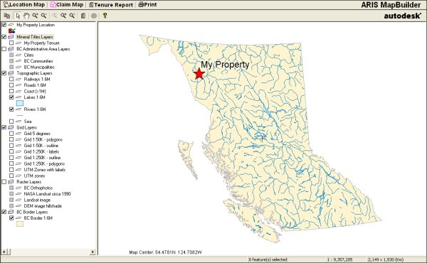
Generate Property Location Map- The map opens and displays the property location
- Click Location Map to see the property location (default view)
- Click Print to print a location map

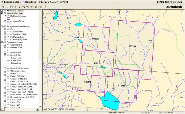
Generate Claim Map
- Click Claim Map to zoom to the property
- Click Print to print a claim map

Note: MTO tenures (numbers 500000 and above) may mask older tenures and Crown grants, which may still be valid. Thus MTO tenure outlines may have to be adjusted to exclude these areas. The MapBuilder Map can be used to custom annotate claim boundaries.
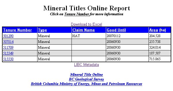
Generate Tenure Report- Click Tenure Report to open a new window with a report of all tenures part of the property. This will include links to the claim information in Mineral Titles Online.
- From the report, the tenure information can be downloaded as an .xls file.
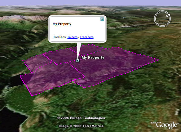
 View Claims in Google Earth
- Click Google Earth to download a .kml file
- Download and install Google Earth in order to view the .kml file

Note: The .kml file will have coordinates of the MTO claim boundaries. In Google Earth, right-click the layer and save as a .kml file. Open the .kml file in Notepad; the coordinates start in the southwest corner, proceed counter clockwise and include the MTO Grid points along the claim boundary.
Contact: Mineral Assessment Geoscientist


